Lot 521
J. Ottens, Atlas Minor. Amsterdam (um 1725-50). Fragment, Erhaltungsmängel.
Estimate
€ 2.000
Starting Price
€ 1.400
Hammer Price
€ 4.500
Lot:
521
Category:
Geography and work of views
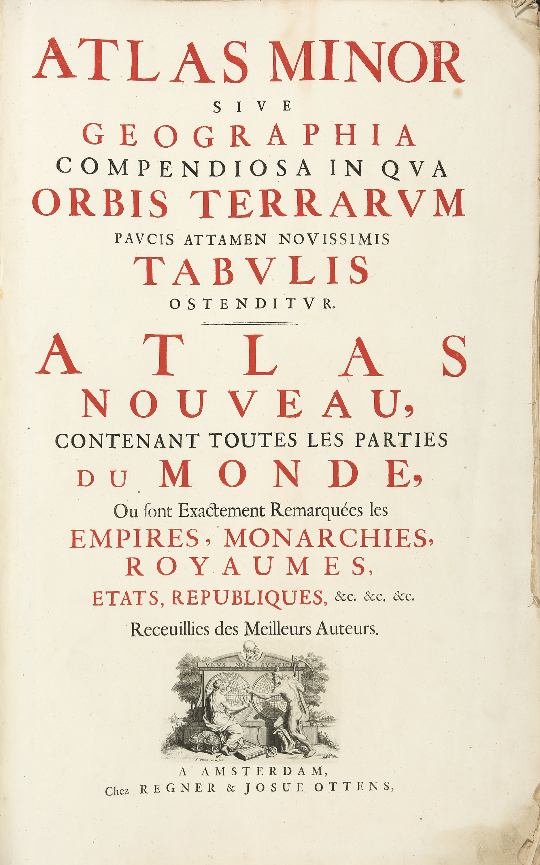
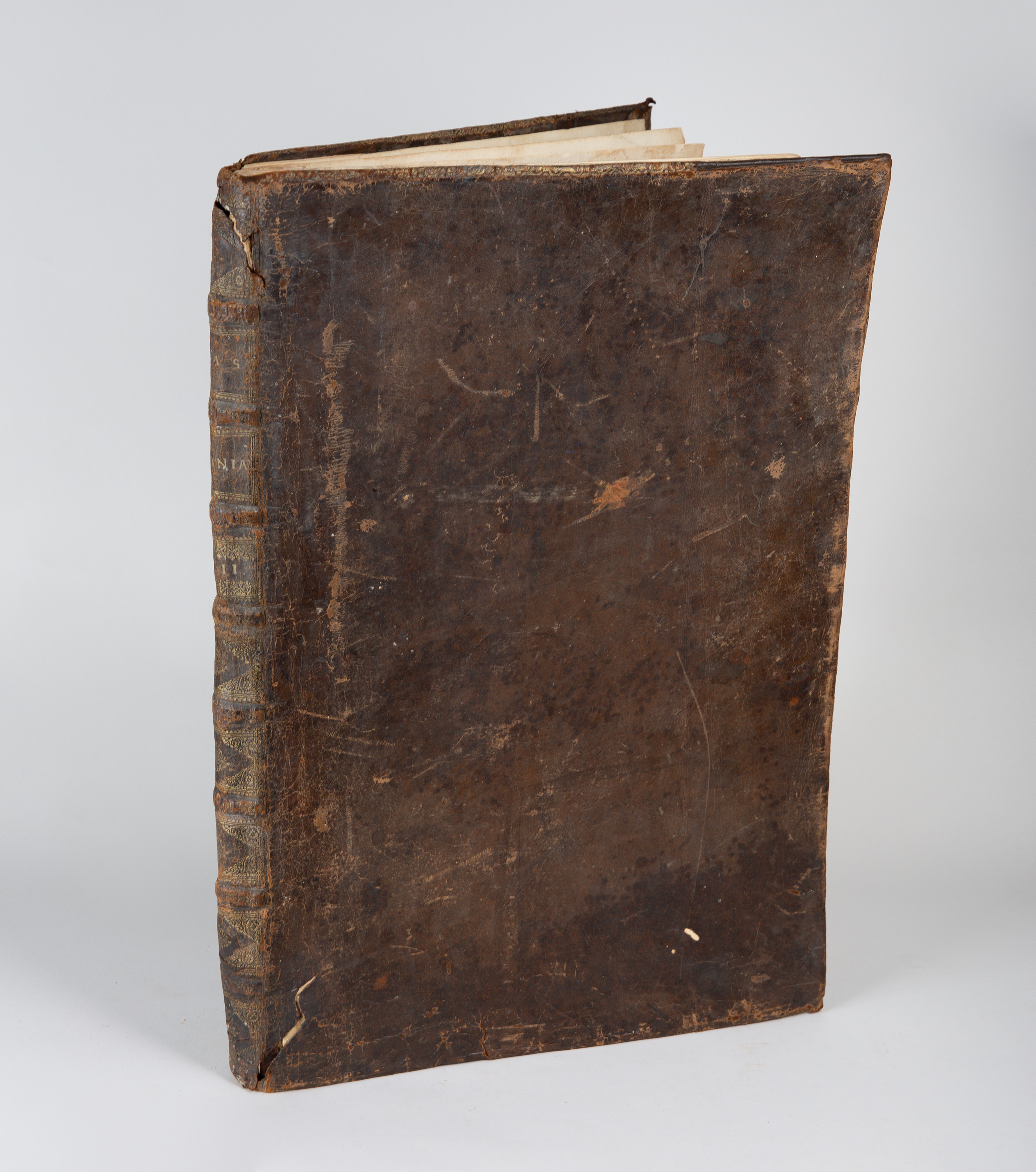
Ottens, Josua: Atlas minor sive geographia compendiosa.../ Atlas nouveau contenant toute les parties du monde... Amsterdam: Regner & Ottens (um 1725-50). 53 x 35 cm. Title page and 27 double-sheet or folded and colored copperplate maps (including a distance table (1) and historical overview charts (3)). Brown leather with spine title.
(Cover and binding damaged; numerous plates and sheets have been removed. The maps as a whole show few signs of age and wear; only a few have visible damage. The ‘Insulae Danicae’ map has been removed from the binding and is enclosed separately. The ‘Van de XVII Provincien’ plate has crease marks. The map of Scandinavia has two tears along the edges that have been repaired.)
Cmp. Koeman III, Ott 1. - Around a third of the original collection of maps still remains. Among the copperplate maps by F. de Wit, H. Jaillot and others are maps of the world, Europe, Asia, Africa, the Americas, Spain, France, Italy, Sicily and Malta, Germany, Switzerland, the Netherlands, Belgium, Great Britain, Denmark, Russia, Poland, Hungary, Scandinavia, Greece, Turkey, the Holy Land and others.
Complete list of maps and plates:
1) Map of the world (Nova totius terrarum orbis tabula)
2) Accuratissima Europae tabula
3) Exactissima Asiae delineatio
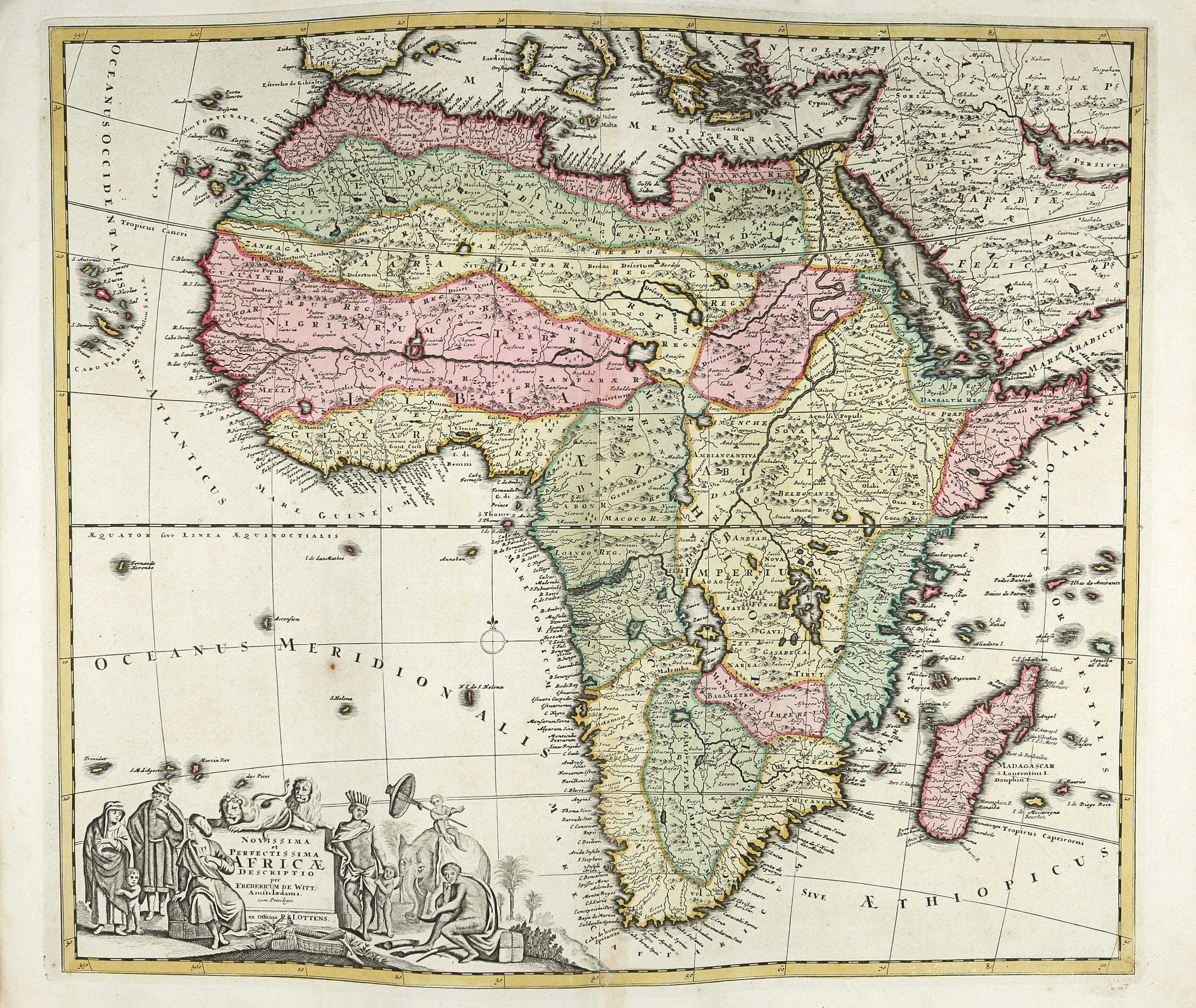
4) Novissima et perfectissima Africae descriptio
5) Recentissima novi orbis sive Americae septentrionalis et meridionalis tabula
6) Historische en geographische Tafel. Om te leren een kortbegrip.
7) Poliometria Europae maxime autem Germaniae ac finitimorum locorum
8) L’Espagne divisée en tous ses royaumes, principautés, &c
9) Accuratissima Galliae tabula (Royaume de France)
10) Novissima et accuratissima totius Italiae, Corsicae et Sardiniae
11) Insulae et regni Siciliae novissima tabula (+ Carte particulière de l’isle de Malte et des isles Voisines)
12) L’empire d’Allemagne
13) Kort begryp van Duytsland, de drie ryx collegien...
14) Novissima et accuratissima Helvetiae Rhaetiae, Valesiae et partis Sabandiae tabula
15) Nieuwe kaart van de XVII Nederlandsche Provincien
16) Tafel van de XVII Nederlandze Provincien
17) Exactissima Belgii foederati tabula cum annexis divisa in provincias
18) Belgii regni
19) Les isles Britannique
20) Daniae regnum
21) Carte nouvelle de tout l’empire de la grande Russie
22) Reipublicae et status generalis Poloniae nova tabula
23) Novissima tabula regni Hungariae
24) Scandinavia complectens Sueviae, Daniae & Norvegiae regna
25) Graeciae et archipelago
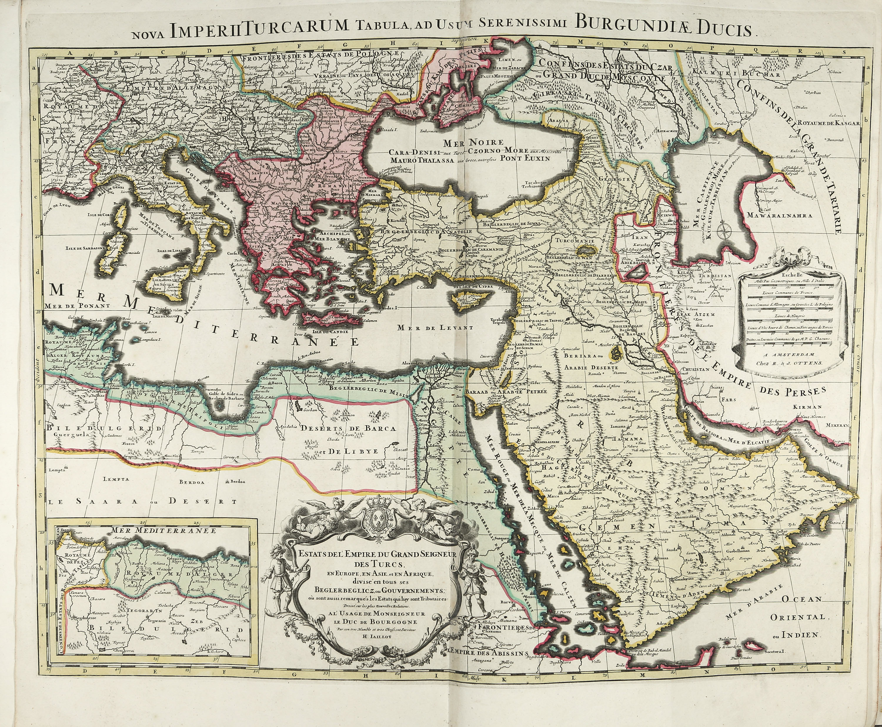
26) Nova imperii Turcarum tabula
27) Terra Sancta
28) Insulae Danicae
(Cover and binding damaged; numerous plates and sheets have been removed. The maps as a whole show few signs of age and wear; only a few have visible damage. The ‘Insulae Danicae’ map has been removed from the binding and is enclosed separately. The ‘Van de XVII Provincien’ plate has crease marks. The map of Scandinavia has two tears along the edges that have been repaired.)
Cmp. Koeman III, Ott 1. - Around a third of the original collection of maps still remains. Among the copperplate maps by F. de Wit, H. Jaillot and others are maps of the world, Europe, Asia, Africa, the Americas, Spain, France, Italy, Sicily and Malta, Germany, Switzerland, the Netherlands, Belgium, Great Britain, Denmark, Russia, Poland, Hungary, Scandinavia, Greece, Turkey, the Holy Land and others.
Complete list of maps and plates:
1) Map of the world (Nova totius terrarum orbis tabula)
2) Accuratissima Europae tabula
3) Exactissima Asiae delineatio
4) Novissima et perfectissima Africae descriptio
5) Recentissima novi orbis sive Americae septentrionalis et meridionalis tabula
6) Historische en geographische Tafel. Om te leren een kortbegrip.
7) Poliometria Europae maxime autem Germaniae ac finitimorum locorum
8) L’Espagne divisée en tous ses royaumes, principautés, &c
9) Accuratissima Galliae tabula (Royaume de France)
10) Novissima et accuratissima totius Italiae, Corsicae et Sardiniae
11) Insulae et regni Siciliae novissima tabula (+ Carte particulière de l’isle de Malte et des isles Voisines)
12) L’empire d’Allemagne
13) Kort begryp van Duytsland, de drie ryx collegien...
14) Novissima et accuratissima Helvetiae Rhaetiae, Valesiae et partis Sabandiae tabula
15) Nieuwe kaart van de XVII Nederlandsche Provincien
16) Tafel van de XVII Nederlandze Provincien
17) Exactissima Belgii foederati tabula cum annexis divisa in provincias
18) Belgii regni
19) Les isles Britannique
20) Daniae regnum
21) Carte nouvelle de tout l’empire de la grande Russie
22) Reipublicae et status generalis Poloniae nova tabula
23) Novissima tabula regni Hungariae
24) Scandinavia complectens Sueviae, Daniae & Norvegiae regna
25) Graeciae et archipelago
26) Nova imperii Turcarum tabula
27) Terra Sancta
28) Insulae Danicae